Growing Returns

Selected tag(s): flood

Five reasons why mandatory flood disclosure in Florida would be a big win for realtors

By: Rachel Rhode, Manager, Climate Resilient Coasts and Watersheds and Eve Cooke, Fellow, Climate Resilient Coasts and Watersheds

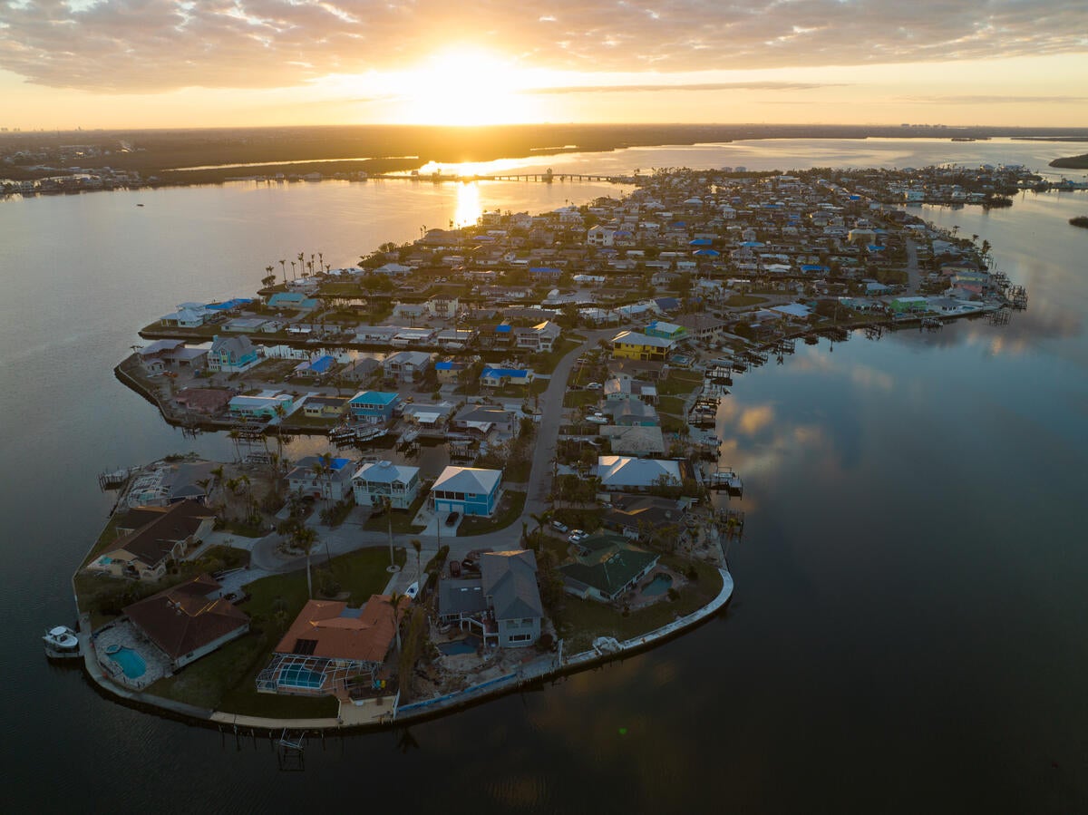
Buying a home is often one of the biggest financial decisions individuals and families will ever make. More than one-third of Florida properties are at risk of severe flooding in the next 30 years, and despite these risks, Florida does not require flood-related disclosures to prospective homebuyers. Across the U.S., 32 states have enacted flood disclosure laws, requiring a seller to share a property’s flood risks or past flood damages during real estate transactions. Florida residents deserve transparency through flood disclosure, and realtors would benefit by keeping up with this growing industry standard.   

Knowing one’s risk is essential in ensuring effective preparedness and response. The Federal Emergency Management Agency estimates just one inch of flooding in a typical 2,500 sq. ft., one-story home can cause more than $25,000 in damages. It is widely misunderstood by more than one-third of homeowners that flood damage is typically not included in standard homeowners or rental insurance policies. 

Legislators and realtors are stepping up to address this gap in Florida’s flood policies. In the 2024 Florida Legislative Session, there has been bipartisan support for a new policy on flood disclosure. The Florida Realtor Association is amongst the stakeholders supporting this initiative. 

Knowledge is power.  Below are the top five reasons why mandatory flood disclosures are a win for realtors and residents. 

Credit: Chase Guttman

Read More »

Posted in Climate Resilience / Also tagged , , , | Comments are closed

Our Nation’s wetlands are at risk. So is our ability to manage flooding.

Following the Sackett v. EPA Supreme Court decision in May 2023, millions of acres of wetlands across the U.S. lost critical federal protections they once had under the Clean Water Act. The affected wetlands – which include those that do not have a continuous surface water connection to another federally protected body of water, like streams, lakes or an ocean – are now potentially at risk of loss and degradation. Also at risk could be the multitude of benefits provided by wetlands, which support clean drinking water, habitat for fish and wildlife, human health and well-being, contribute to economic activity and reduce damages from flooding. 

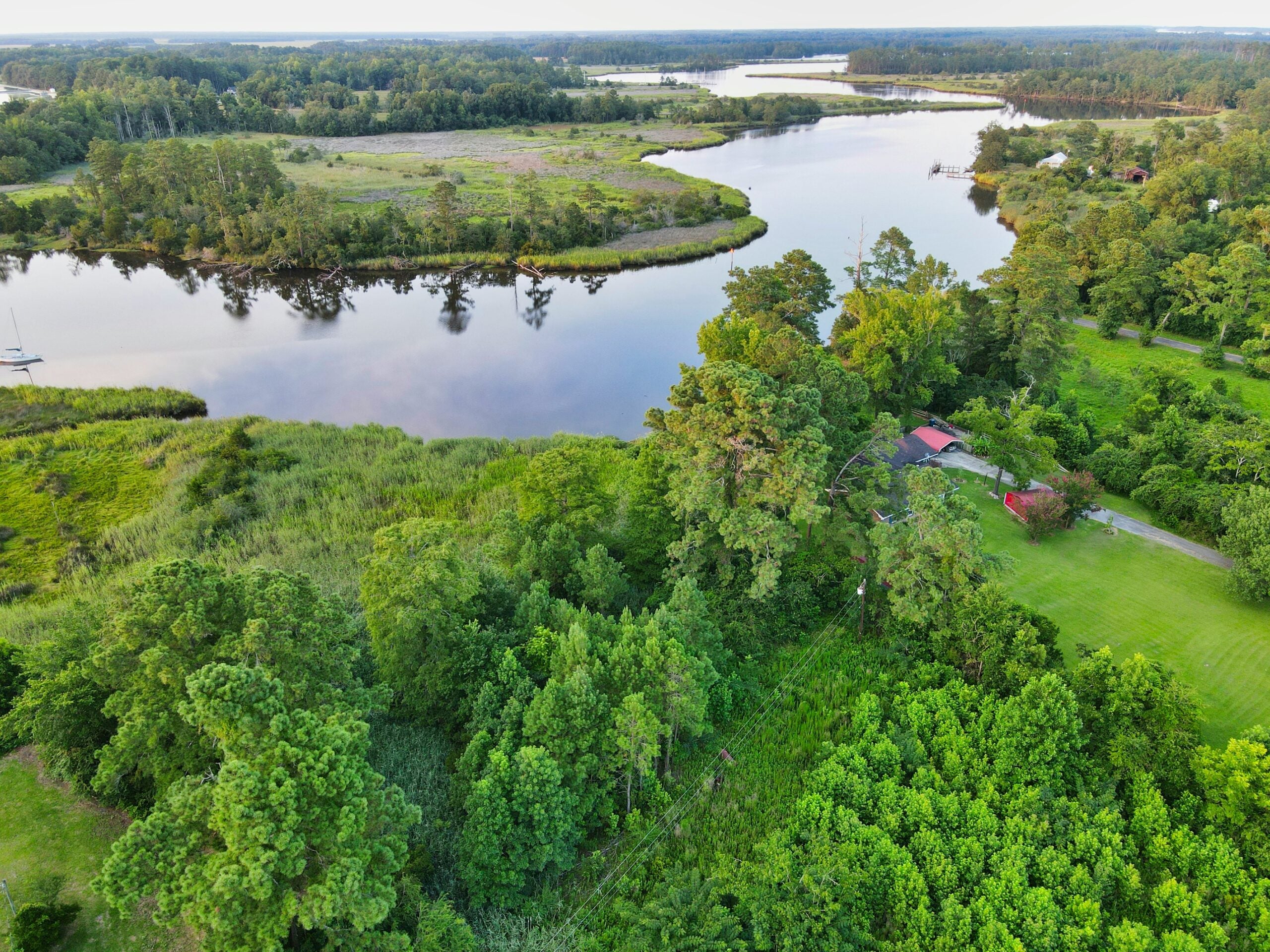
Photo credit: Sara Cottle

Why are these wetlands at risk? 

When the Supreme Court narrowed the definition of federally protected waters, state governments gained control over the regulation and protection of a large portion of wetlands. Unfortunately, many states lack the capacity or political will to regulate the use of wetlands and effectively enforce protective standards. 

Further, economic incentives for the protection of wetlands are misaligned. Private landowners and developers often have limited financial incentive to preserve wetlands because the benefits they derive from protection of these ecosystems do not reflect the total benefits that wetlands provide to society. While conversion of wetlands for housing development or agricultural production may be highly profitable for landowners, it also creates social and environmental costs that may exceed private benefits of conversion. 

Historically, the costs of regulation to private landowners have been well represented in public decision-making processes, but the social benefits of wetland protection have been omitted or underestimated. To ensure efficient protection of wetlands, it is critical that policymakers comprehensively evaluate both the social benefits and private costs of wetlands regulation. 

What are the benefits of protecting wetlands? 

In advocating for wetland protection, it is critical that the full range of benefits from wetlands is accurately quantified and valued. Such benefits include drinking water purification, flood risk reduction, habitat to support fish and wildlife, recreation and carbon storage – all of which become more important with increasing climate impacts. 

As climate change increases the severity and frequency of flooding, the capacity for wetlands to buffer people and property from flood damage becomes ever more valuable. Compared to traditional forms of grey infrastructure (e.g., dams, levees, seawalls), wetlands can be less expensive to maintain and more resilient to catastrophic flood events.  

What is the value of flood mitigation benefits provided by wetlands? 

In recent years, several studies have made important advancements in quantifying the economic value of wetlands for flood mitigation. Many of these studies employ hydrodynamic models which simulate how wetlands can reduce storm surge and the impacts of inland flood inundation. 

Based on this approach, Narayan et al. (2017) found that the loss of all coastal wetlands in the Northeastern U.S. (beyond losses prior to 2011) would have increased damages from Hurricane Sandy by $625 million. Similarly, Zaid Al-Attabi et al. (2023) estimated that the total loss of wetlands in Galveston Bay, TX would have increased damages from Hurricane Ike by $934 million. Importantly, these studies note that the effects of wetlands on flood damages depend on storm characteristics, local topography, landscape features and the presence and location of physical assets exposed to flood risk. 

A lady in a red coat stands in the middle of a puddle on the streets of Breezy Point after Sandy

These analyses provide important tools for simulating the impacts of alternative scenarios with and without wetlands. However, there have been few studies that test the effects of wetland loss on flood damage based on empirical evidence. Plus, more work is needed to understand the flood risk reduction benefits of non-tidal wetlands, which are more likely to be impacted by the Sackett v. EPA ruling.  

To address this gap, Taylor and Druckenmiller (2022) identified the effect of observed changes in wetland area on the value of flood insurance claims using econometric causal inference methods. Across the U.S., they found that a hectare (roughly the size of 2.5 football fields) of wetland lost between 2001 and 2016 cost the National Flood Insurance Program (NFIP) an average of $1,840 annually and over $8,000 annually in developed areas.  

What are the next steps? 

Researchers at Environmental Defense Fund (EDF) and UNC Chapel Hill are collaborating to better understand the flood risk reduction benefits of wetlands and how they are distributed across demographic and socioeconomic groups. Using observed NFIP claims data identified at the level of individual street addresses, this approach allows for a more accurate identification of when, where and for whom wetlands are most valuable. This study is being piloted in the Neuse River Basin in North Carolina with the intention to scale to other areas across the nation.  

In addition to motivating greater state and federal protection, quantifying the value of wetland ecosystem services is important for designing financial incentives and prioritizing areas for protection and restoration. For instance, one potential application could provide incentives for wetland protection or restoration by offering discounts on flood insurance premiums that correspond with the value of flood mitigation associated with upstream wetlands. Another potential application could provide conservation organizations and floodplain managers with additional information to help prioritize investments in restoration and protection.  

For these applications and others, building a more granular understanding of the geographic, temporal and ecological variation in the flood mitigation benefits provided by wetlands is critical. And overall, it is important that these benefits be viewed as part of a larger whole of the many instrumental and intrinsic values that wetlands provide.  

EDF is working together with scientists, economists, advocates and policymakers to better quantify, communicate and protect the breadth and value of ecosystem services provided by wetlands. This will require cutting-edge advancements in science and economics that are then translated to the public and to decision-makers in ways that are policy- and place-specific.  


Posted in Climate Resilience / Also tagged , , , | Comments are closed

Advancing North Carolina’s Flood Resiliency Blueprint to combat growing storm risks

Over the past five years, North Carolina communities have endured storm after storm. From the estimated $16 billion of damage caused by the powerful forces of Hurricane Florence to excessive rainfall that engulfed mountain towns during Tropical Storm Fred to the lasting impacts from various unnamed storms, we’ve seen firsthand how flooding disasters are changing North Carolina and its communities.  

Now, more than ever, new approaches are required to address the increasing rate and severity of extreme rain events in North Carolina to safeguard communities, ecosystems and local economies. One way to reduce these risks is to build flood resilience across the state, an effort that has proven to save $6 for every $1 spent pre-disaster 

North Carolina’s Department of Environmental Quality (DEQ) is developing the state’s first-ever Flood Resiliency Blueprint in collaboration with numerous stakeholders, including Environmental Defense Fund (EDF), conservation partners, agricultural organizations, business representatives and local governments. And we are thrilled to celebrate the release of DEQ’s draft plan, which was presented to the General Assembly on January 23.  

At the Joint Legislative Commission on Government Operations Hurricane Response and Recovery subcommittee, DEQ Secretary Elizabeth Biser envisioned that “five years from now, other states will be looking to North Carolina because our process lets communities get back to day to day living quicker after storm events.” The Blueprint is a big step forward, resulting in a massive statewide effort dedicated to building resilient communities equipped to reduce and manage flood risk and vulnerabilities. 

Photo credit: Gene Gallin

Read More »

Posted in Climate Resilience / Also tagged , , , | Comments are closed

4 opportunities for Virginia’s General Assembly to build statewide flood resilience

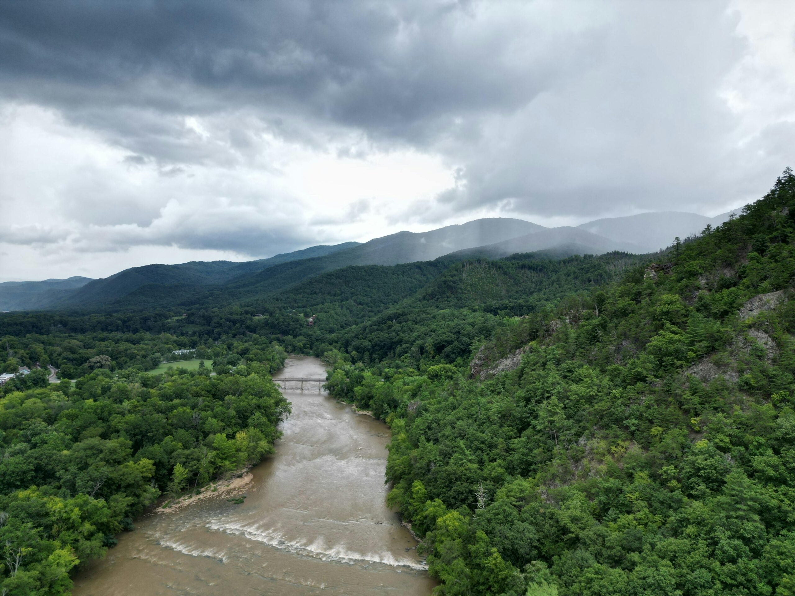
In recent years, flash floods have decimated homes, businesses and communities in southwest Virginia and families are still recovering and rebuilding from the damage. Research shows that investing in flood resilience saves at least $6 for every $1 spent pre-disaster, which is why it’s so important to start planning for climate impacts now. 

While many localities are taking steps to plan for current and future climate impacts, many lower-resourced, small or rural communities need additional support from statewide planning initiatives, funding programs and technical assistance to address their flood risk. Virginia leaders must continue to build flood resilience through four big initiatives. 

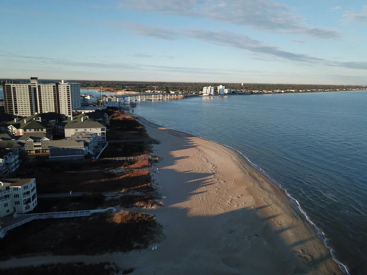
Beach

Read More »

Posted in Climate Resilience / Also tagged , , , | Comments are closed

The impact of storm surge barriers on estuaries and ecosystems

By Philip Orton, Research Associate Professor, Stevens Institute of Technology

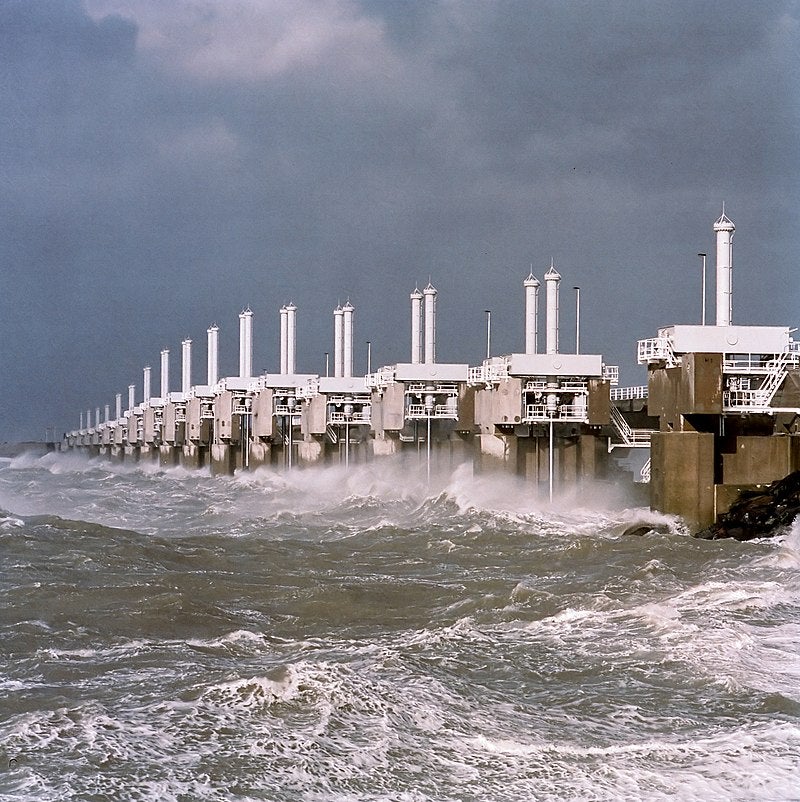
Due to the increasing frequency and risk of coastal storms and flood disasters, many governments and decision makers are looking to construct gated storm surge barriers.

The U.S. Army Corps of Engineers is recommending these large steel and concrete barriers be built across entrances to 11 U.S. estuaries, enabling closure during storm surges to minimize coastal flooding. However, many scientists are wary of the potential effects these barriers could have on coastal ecosystems, leading many advocates to push for a precautionary approach or their outright rejection.

Published in the scientific journal Earth’s Future and supported in part by funding from  Environmental Defense Fund, colleagues and I recently formulated a new research agenda focused on the intersection between the increased use of storm surge barriers and the resulting estuary impacts. These are three key takeaways from our research:

Photo by: Rens Jacobs
Rijkswaterstaat, Data-ICT-Dienst, Beeldarchief Rijkswaterstaat

Read More »

Posted in Climate Resilience / Also tagged , , , , | Comments are closed

How states can finance coastal resilience before the next disaster

As climate change drives more intense storms, hurricane-related costs in the United States have increased 1,100% since 1980, and the population of counties prone to hurricane damage has increased at least 22% faster than the overall U.S. population has grown.

State governments must prioritize rebuilding better and investing in climate resilience now to avoid the skyrocketing costs of future disasters. Every $1 invested to mitigate a disaster saves $6 in recovery. Read More »

Posted in Uncategorized / Also tagged , , , , , , , , , | Comments are closed

More Americans are at risk of flooding than ever before. Here’s how to address this new reality.

Imagine going to bed thinking your home is safe only to wake up and discover that you’re living in the middle of a vulnerable flood zone.

That’s essentially what happened to millions of Americans recently when the research and technology nonprofit First Street Foundation released a report showing how much damage climate-induced flooding could inflict on homes and businesses in the next 30 years. Read More »

Posted in Uncategorized / Also tagged , , , , | Comments are closed

Attention Congress: Investing in nature can help our flood-ravaged nation

Call 2019 the year of the flood.

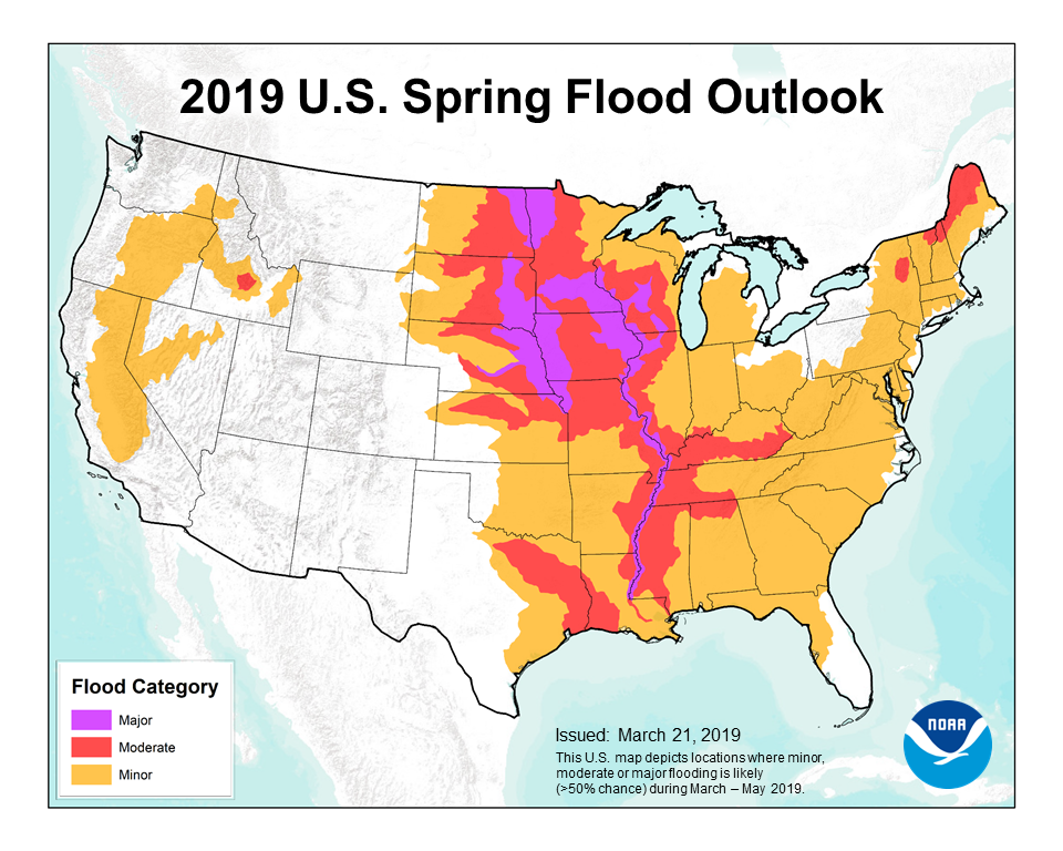
This spring large swaths of the nation experienced moderate to severe flooding – and the rain isn’t stopping. In California, record rainfall and snow persisted into May. In Louisiana, for the first time ever, the Army Corps of Engineers just released water through its Bonne-Carré spillway twice in a single year to avoid flooding. And hurricane season is just beginning.

Photo Credit: NOAA

The deluge of floods is hardly a coincidence.

Land-use changes and extreme weather driven by climate change are delivering a one-two punch that heightens flood risk. We’ve increased impervious surfaces – think asphalt and concrete – and at the same time we’ve removed wetlands, prairies and forests, which can absorb water and slow runoff. We’ve also built hard infrastructure such as bridges, urban and agriculture drainage networks, and even, ironically, flood “protection” projects that often alter watersheds, floodplains and stream hydrology and increase the severity of floods.

So how do we better protect critical infrastructure and communities in the face of increased flooding? Read More »

Posted in Uncategorized / Also tagged , | Comments are closed

States are turning to data and interactive maps to help residents confront and manage flood risks

2019 has been an unprecedented year for flooding, even before the start of hurricane season. Despite the number of devastating hurricanes in recent years, a new University of Notre Dame study published in Climatic Change found that most coastal residents do not plan to take preventative action to reduce damages.

In addition to speeding up the recovery process, taking action before disaster strikes can help homeowners reduce damages, save money and even lives. For riverine floods, every dollar spent before a disaster saves $7 in property loss, business interruption and death.

So how can individuals, businesses and the public sector be incentivized to make proactive investments to reduce vulnerability before a disaster strikes? The first step is clearly understanding risks—now and in the future—and having concrete recommendations for how to mitigate them.

In the past, FEMA’s National Flood Insurance Rate Maps have been the source for this information; however, these probability-based maps have not resonated with most people as they rely on the obscure “100-year floodplain” concept. Being told you live in an area that has a 1 percent chance of flooding any given year does not inspire action, nor does it reflect the reality of a changing climate.

In recent years, states have stepped up with more robust tools that give residents a clearer depiction of risks and resources for how to reduce them. Three states stand out. Read More »

Posted in Uncategorized / Also tagged , , , , | Comments are closed

Immediate steps for North Carolina policymakers to reduce flood risks and build resilience

As the moment of crisis recedes in memory, it would be easy to shift our collective focus away from last year’s hurricanes. But we must remember that the work of rebuilding homes and livelihoods along the coast and across the coastal plain is really just beginning.

With two 500-year storms in a 23-month period, North Carolina policymakers and communities need to be better prepared for storms and flooding in the future.

In the aftermath of Hurricanes Florence and Michael, with rainfall totaling in the trillions of gallons, numerous recommendations were put forward to address the risks posed by flooding and extreme weather in North Carolina.

Those recommendations included targeted solutions such as clearing debris from rivers and streams that may address flooding in one community, but exacerbate it elsewhere. Others offered engineered approaches such as dams that can take decades to build, require state acquisition of private lands, and, once built, are fixed in place eliminating flexibility.

While some stream dredging or construction of levees in key locations may need to be part of a solution set, there are other immediate steps that we can take to reduce flood risks. Read More »

Posted in Uncategorized / Also tagged , , , | Read 1 Response