Capturing water from atmospheric rivers will help build drought resilience in California. Here’s how.
Posted: in Agriculture, Water
Written By
Share
This blog was co-authored by Nicole Schmidt, a recent graduate from UC Santa Barbara’s Bren School of Environmental Science and Management.
Several locations in California set all-time 24-hour rainfall records this past weekend when an atmospheric river delivered much needed precipitation as the majority of the state remains in extreme drought conditions.
In Sacramento, this wettest day on record followed the longest consecutive dry spell on record amid California’s second driest year.
As scientists have been predicting, climate change is causing more dramatic extremes in weather — both wet and dry — and that pendulum swung very dramatically to the wet side over the weekend.
Consequently, it’s critical we prepare now to capture and store water during these shorter, intense wet periods so that more water is available during the inevitable increasingly severe drought years ahead.
Boosting storage capacity to recharge water supplies
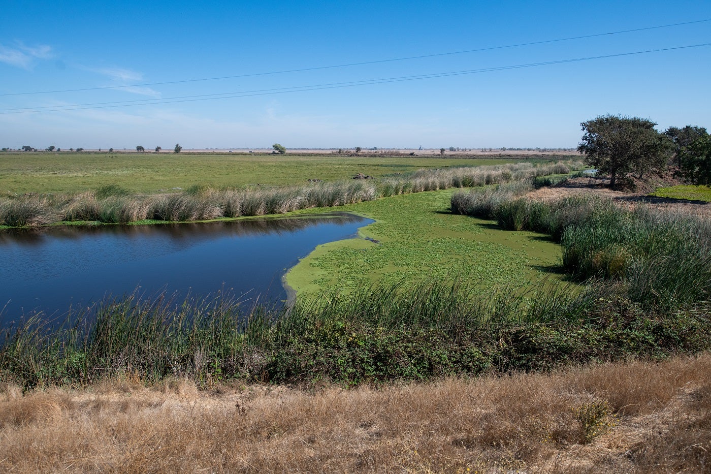
Floodplain restoration is one effective but underutilized water storage technique that uses natural infrastructure to deliver multiple benefits, including recharging groundwater basins, reducing flood risk and creating more wildlife habitat.
Floodplain restoration is one effective but underutilized technique that can capture and store water from an atmospheric river so that more water is available during inevitable dry periods. Share on XTo maximize this opportunity, EDF and the California Department of Water Resources worked with a graduate student team from the UC Santa Barbara Bren School of Environmental Science and Management to develop a methodology to help water managers and stakeholders determine the best sites for multibenefit floodplain restoration projects.
The results are outlined in a recently released report, Flood Forward, written by Bren students Alex Ehrens, Annika Leiby, Alex Milward and Nicole Schmidt.
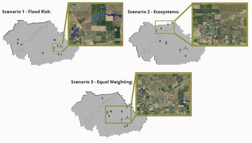
The Flood Forward team created a framework to identify areas adjacent to streams where restored floodplains can deliver multiple benefits through flood-managed aquifer recharge — a practice that captures and directs excess water during atmospheric rivers like we just experienced to replenish groundwater basins beneath agricultural and natural lands. Such recharge is becoming more important as local agencies work to balance groundwater supply and demand to comply with the Sustainable Groundwater Management Act.
A three-step framework
Here are the steps that the Flood Forward team took to create their model:
- Risk reduction analysis: The team used five variables to identify watersheds with the highest flood risk score, which would also make them the strongest candidates for restoration: historic levee failures; FEMA flood hazard; fire hazard; disadvantaged community presence; and watershed drainage area.
- Groundwater recharge potential: The team then combined the flood risk score with groundwater recharge potential, which was determined by a previous EDF and Bren School research project, Recharge for Resilience.
- Ecosystem benefits: The Flood Forward team prioritized areas for improving habitat using three variables: proximity to critical habitat and groundwater dependent ecosystems and diversity of native species.
More intense droughts in California punctuated by intense periods of wet weather are becoming the rule, not the exception. The Flood Forward model is one tool that can help stakeholders and local agencies do a better job adapting to this reality by capturing as much water as possible while reducing flood risks and creating other co-benefits during wet years to help us get through increasingly severe dry periods.
Preparing for and capitalizing on these swings in extreme weather will be crucial to boosting the long-term resilience of our water systems in the West.