Growing Returns

Developing effective ways to measure a community’s climate resilience

Co-authored by: Anushi Garg and Ravena Pernanand

Anushi is the senior analyst for Environmental Defense Fund’s Climate Resilient Coasts & Watersheds program in New York-New Jersey. Ravena is a research analyst at Regional Plan Association.

Across the globe, we are experiencing detrimental impacts from climate change, with low-wealth communities and communities of color hit the hardest. And while there are several ways we can measure climate impacts — such as determining sea level rise or increasing temperatures — we still lack ways to easily answer the question “how resilient are we?” Or “how does one community’s resilience compare to another?” The right tools are needed to understand how well our communities, ecosystems and infrastructure bounce back from or avoid climate impacts in order for government officials, advocates and community members to effectively assess, track and implement future solutions.  

To address this gap, Environmental Defense Fund (EDF) and Regional Plan Association (RPA) collaborated on a pilot project alongside partners and stakeholders in New York City. We characterized stakeholders’ resilience priorities, such as having access to affordable and climate-safe shelter, and identified indicators that could measure the progress of these priorities.  

This project lays the groundwork for developing resilience report cards that are useful to different regions, evidence-based and community informed, as well as identify specific targets that can be easily updated and support advocacy and management decision-making. Take a look at the three key findings from our project’s report: 

1. We have many excellent tools to measure vulnerability and climate hazards but lack ways to measure resilience  

There are many indicators and mapping tools that local, state and federal officials and the nonprofit sector have developed to measure social vulnerability and exposure to natural hazards like flooding. In addition, some tools look at environmental justice, such as FEMA’s new Community Disaster Resilience Zones platform or EDF’s Climate Vulnerability Index, in addition to tools that address this on a local scale. 

While demographic and climate hazards are important to inform resource targeting, they cannot tell us if the systems, meaning the interacting group of components that make up the core attributes of resilience, are functioning and at what level. Using these tools in combination with resilience indicators can provide greater insight into management decision making and in tracking progress.  

Resilience indicators can be combined with social vulnerability and hazard data across geographies to inform us about how functional or present different attributes of resilience are in areas of varying risk. / Source: Ellis Calvin, RPA

2. Indicators should be aligned with stakeholder priorities 

Following Hurricane Sandy, communities throughout New York City developed local resilience plans to ensure residents were better prepared for worsening climate impacts. For this project, EDF and RPA collected and analyzed 41 community-based plans to see if priorities were consistently articulated at the community level. Then through a series of community stakeholder workshops, we consolidated more than 500 goals and identified indicators that could be used to measure progress toward those goals.  

We also reviewed an array of existing academic and gray literature and analyzed commonalities and differences in the way the communities and scientists evaluate resilience. Science typically focuses on systems, while communities overwhelmingly focus on outcomes. We used this as an opportunity to integrate science with the community’s experiential knowledge to develop indicators that can improve both existing conditions and systems. 

3. We need user-friendly ways to evaluate success and shortcomings in resilience planning and management  

Through the project, we identified three primary users for resilience indicators and metrics.  

This map demonstrates how a single indicator, in this case hazardous and chemical bulk storage sites, can be mapped along with social vulnerability and hazard exposure to inform more targeted management action. See also New York City Environmental Justice Alliance’s Waterfront Justice Project, which first identified the importance of mapping these sites in the context of the floodplain in the New York City area. / Source: Ravena Pernanand, RPA

  • Government managers, such as Chief Resilience Officers, can use indicators to evaluate the resilience of individual systems (e.g., infrastructure) and combine them with social vulnerability and hazard data to evaluate and compare across geographies and better triage funding, strategies and assistance. This allows managers to track progress, evaluate the effectiveness of strategies and facilitate collaboration across agencies toward shared goals and measurements.  
  • Advocates can use indicators by combining them into a simple index or resilience report card. This could help demonstrate if an area or district is underperforming compared to others, as well as build public pressure to prompt government action.  
  • Community-based organizations provide their communities with direct services related to resilience. A set of measurable indicators could be used to leverage financial support and guide participatory budgeting processes that foster the community’s improvement. The indicators could also educate community members about their neighborhood, help them gather community-led data and inform community-focused resilience plans.  

There are several examples already of how this work might be applicable in resilience efforts. New York City’s Office of Management and Budget is currently working on developing a climate budgeting process which would track the impacts of the city’s budget on making climate improvements across all city agencies. New York has already announced a commitment to develop a comprehensive plan to build statewide climate resilience. As funding and opportunities for resilience planning and implementation become available, it is an opportune time to adopt measurable indicators as an accountability and best management practice by engaging with advocates, community-based organizations and governments and producing or co-developing user-oriented versions of this report.  

We encourage partners, agencies and academia to join us in closing the resilience data gaps and use the findings from this report to prioritize resilience and improve decision making. 

Posted in Climate Resilience / Tagged , , , | Comments are closed

PACE Crop Insurance helps an Illinois farmer improve conservation and save money

Co-authored by Pinion

The use and production of fertilizer in agriculture is a significant contributor to greenhouse gas emissions and a major cause of pollution in the nation’s rivers and lakes. Agriculture is the largest global source of nitrogen pollution, and annual damages from nitrogen pollution are estimated to exceed $200 billion in the US. Enhancing nitrogen use efficiency and optimizing application techniques is essential to reducing these impacts.

Read More »

Posted in Uncategorized / Tagged , , , , , | Comments are closed

How food companies can harness the power of social networks for scope 3 reductions

As the spotlight on the food sector’s impact on global emissions grows, particularly as the voluntary and regulatory spaces for agriculture, forestry, and other land use drive increasing scrutiny, many major food companies have announced ambitious science-based climate targets. Food and agriculture companies face a unique challenge in meeting these targets, however, as the lion’s share of their emissions lie in their Scope 3 — on the farms that supply their products and ingredients. Driving down those emissions requires companies to engage and support farmers to roll out climate solutions.

While many are rightly focused on financial incentives to encourage adoption of climate-smart agriculture practices, a newly released report sheds light on another, under-appreciated lever of change: farmers’ social networks.

New research from Colorado State University, funded by Environmental Defense Fund, explores how companies can work with farming communities via social networks to meet climate goals and drive reductions in scope 3 emissions, while building farmer resilience to climate change shocks. Read More »

Posted in Uncategorized / Tagged , | Comments are closed

Five reasons why mandatory flood disclosure in Florida would be a big win for realtors

By: Rachel Rhode, Manager, Climate Resilient Coasts and Watersheds and Eve Cooke, Fellow, Climate Resilient Coasts and Watersheds

Buying a home is often one of the biggest financial decisions individuals and families will ever make. More than one-third of Florida properties are at risk of severe flooding in the next 30 years, and despite these risks, Florida does not require flood-related disclosures to prospective homebuyers. Across the U.S., 32 states have enacted flood disclosure laws, requiring a seller to share a property’s flood risks or past flood damages during real estate transactions. Florida residents deserve transparency through flood disclosure, and realtors would benefit by keeping up with this growing industry standard.   

Knowing one’s risk is essential in ensuring effective preparedness and response. The Federal Emergency Management Agency estimates just one inch of flooding in a typical 2,500 sq. ft., one-story home can cause more than $25,000 in damages. It is widely misunderstood by more than one-third of homeowners that flood damage is typically not included in standard homeowners or rental insurance policies. 

Legislators and realtors are stepping up to address this gap in Florida’s flood policies. In the 2024 Florida Legislative Session, there has been bipartisan support for a new policy on flood disclosure. The Florida Realtor Association is amongst the stakeholders supporting this initiative. 

Knowledge is power.  Below are the top five reasons why mandatory flood disclosures are a win for realtors and residents. 

Credit: Chase Guttman

Read More »

Posted in Climate Resilience / Tagged , , , , | Comments are closed

Lenders want to support farmers’ conservation efforts. Here’s how their executives can help.

corn plants in a conservation practice field in the midwest

Low angle view of young corn plants in a field after the rain


A new survey of agricultural lenders in the upper Midwest reveals important insights about their perceptions and support for farmers’ conservation efforts. As the first of its kind, the survey can inform agricultural lending institutions’ climate and sustainability strategy development.

Farmers rely on agricultural lending institutions for loans to cover equipment, land and operating expenses. In particular, loan officers at these institutions hold relationships with farmers and are often seen as trusted advisers and sources of information. Their perspectives and knowledge of conservation agriculture can significantly influence farmers’ progress in adopting conservation practices.

Read More »

Posted in Uncategorized / Tagged , , , , , , | Comments are closed

Our Nation’s wetlands are at risk. So is our ability to manage flooding.

Following the Sackett v. EPA Supreme Court decision in May 2023, millions of acres of wetlands across the U.S. lost critical federal protections they once had under the Clean Water Act. The affected wetlands – which include those that do not have a continuous surface water connection to another federally protected body of water, like streams, lakes or an ocean – are now potentially at risk of loss and degradation. Also at risk could be the multitude of benefits provided by wetlands, which support clean drinking water, habitat for fish and wildlife, human health and well-being, contribute to economic activity and reduce damages from flooding. 

Photo credit: Sara Cottle

Why are these wetlands at risk? 

When the Supreme Court narrowed the definition of federally protected waters, state governments gained control over the regulation and protection of a large portion of wetlands. Unfortunately, many states lack the capacity or political will to regulate the use of wetlands and effectively enforce protective standards. 

Further, economic incentives for the protection of wetlands are misaligned. Private landowners and developers often have limited financial incentive to preserve wetlands because the benefits they derive from protection of these ecosystems do not reflect the total benefits that wetlands provide to society. While conversion of wetlands for housing development or agricultural production may be highly profitable for landowners, it also creates social and environmental costs that may exceed private benefits of conversion. 

Historically, the costs of regulation to private landowners have been well represented in public decision-making processes, but the social benefits of wetland protection have been omitted or underestimated. To ensure efficient protection of wetlands, it is critical that policymakers comprehensively evaluate both the social benefits and private costs of wetlands regulation. 

What are the benefits of protecting wetlands? 

In advocating for wetland protection, it is critical that the full range of benefits from wetlands is accurately quantified and valued. Such benefits include drinking water purification, flood risk reduction, habitat to support fish and wildlife, recreation and carbon storage – all of which become more important with increasing climate impacts. 

As climate change increases the severity and frequency of flooding, the capacity for wetlands to buffer people and property from flood damage becomes ever more valuable. Compared to traditional forms of grey infrastructure (e.g., dams, levees, seawalls), wetlands can be less expensive to maintain and more resilient to catastrophic flood events.  

What is the value of flood mitigation benefits provided by wetlands? 

In recent years, several studies have made important advancements in quantifying the economic value of wetlands for flood mitigation. Many of these studies employ hydrodynamic models which simulate how wetlands can reduce storm surge and the impacts of inland flood inundation. 

Based on this approach, Narayan et al. (2017) found that the loss of all coastal wetlands in the Northeastern U.S. (beyond losses prior to 2011) would have increased damages from Hurricane Sandy by $625 million. Similarly, Zaid Al-Attabi et al. (2023) estimated that the total loss of wetlands in Galveston Bay, TX would have increased damages from Hurricane Ike by $934 million. Importantly, these studies note that the effects of wetlands on flood damages depend on storm characteristics, local topography, landscape features and the presence and location of physical assets exposed to flood risk. 

A lady in a red coat stands in the middle of a puddle on the streets of Breezy Point after Sandy

These analyses provide important tools for simulating the impacts of alternative scenarios with and without wetlands. However, there have been few studies that test the effects of wetland loss on flood damage based on empirical evidence. Plus, more work is needed to understand the flood risk reduction benefits of non-tidal wetlands, which are more likely to be impacted by the Sackett v. EPA ruling.  

To address this gap, Taylor and Druckenmiller (2022) identified the effect of observed changes in wetland area on the value of flood insurance claims using econometric causal inference methods. Across the U.S., they found that a hectare (roughly the size of 2.5 football fields) of wetland lost between 2001 and 2016 cost the National Flood Insurance Program (NFIP) an average of $1,840 annually and over $8,000 annually in developed areas.  

What are the next steps? 

Researchers at Environmental Defense Fund (EDF) and UNC Chapel Hill are collaborating to better understand the flood risk reduction benefits of wetlands and how they are distributed across demographic and socioeconomic groups. Using observed NFIP claims data identified at the level of individual street addresses, this approach allows for a more accurate identification of when, where and for whom wetlands are most valuable. This study is being piloted in the Neuse River Basin in North Carolina with the intention to scale to other areas across the nation.  

In addition to motivating greater state and federal protection, quantifying the value of wetland ecosystem services is important for designing financial incentives and prioritizing areas for protection and restoration. For instance, one potential application could provide incentives for wetland protection or restoration by offering discounts on flood insurance premiums that correspond with the value of flood mitigation associated with upstream wetlands. Another potential application could provide conservation organizations and floodplain managers with additional information to help prioritize investments in restoration and protection.  

For these applications and others, building a more granular understanding of the geographic, temporal and ecological variation in the flood mitigation benefits provided by wetlands is critical. And overall, it is important that these benefits be viewed as part of a larger whole of the many instrumental and intrinsic values that wetlands provide.  

EDF is working together with scientists, economists, advocates and policymakers to better quantify, communicate and protect the breadth and value of ecosystem services provided by wetlands. This will require cutting-edge advancements in science and economics that are then translated to the public and to decision-makers in ways that are policy- and place-specific.  


Posted in Climate Resilience / Tagged , , , , | Comments are closed

Advancing North Carolina’s Flood Resiliency Blueprint to combat growing storm risks

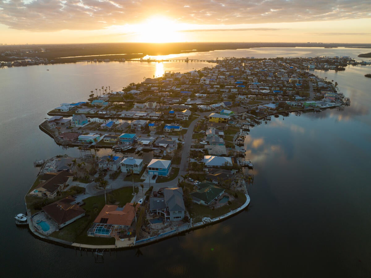
Over the past five years, North Carolina communities have endured storm after storm. From the estimated $16 billion of damage caused by the powerful forces of Hurricane Florence to excessive rainfall that engulfed mountain towns during Tropical Storm Fred to the lasting impacts from various unnamed storms, we’ve seen firsthand how flooding disasters are changing North Carolina and its communities.  

Now, more than ever, new approaches are required to address the increasing rate and severity of extreme rain events in North Carolina to safeguard communities, ecosystems and local economies. One way to reduce these risks is to build flood resilience across the state, an effort that has proven to save $6 for every $1 spent pre-disaster 

North Carolina’s Department of Environmental Quality (DEQ) is developing the state’s first-ever Flood Resiliency Blueprint in collaboration with numerous stakeholders, including Environmental Defense Fund (EDF), conservation partners, agricultural organizations, business representatives and local governments. And we are thrilled to celebrate the release of DEQ’s draft plan, which was presented to the General Assembly on January 23.  

At the Joint Legislative Commission on Government Operations Hurricane Response and Recovery subcommittee, DEQ Secretary Elizabeth Biser envisioned that “five years from now, other states will be looking to North Carolina because our process lets communities get back to day to day living quicker after storm events.” The Blueprint is a big step forward, resulting in a massive statewide effort dedicated to building resilient communities equipped to reduce and manage flood risk and vulnerabilities. 

Photo credit: Gene Gallin

Read More »

Posted in Climate Resilience / Tagged , , , , | Comments are closed

Increasing extreme heat is hurting Kansas farmers’ bottom line

Grain silo over a golden wheat field

During the summer of 2023, Kansas endured a historic heat wave with temperatures soaring above 110°F in some areas. As climate change continues to intensify, the frequency and severity of extreme heat are projected to increase. Are Kansas farmers at risk of losing money in the face of these extreme growing conditions? A new study by EDF, Kansas State University and Cornell University aimed to answer this question by examining the impacts of extreme heat over the last four decades.

Read More »

Posted in Uncategorized / Tagged , , , , , , , , | Comments are closed

Sharing innovative solutions to build climate resilience in Cuban coastal communities

The sun beats hot past colonial facades and newly minted hotels in Old Havana, onto the children playing soccer across Paseo del Prado. High tides splash over the tidal wall and the taxi driver notes, over the noise of the street, that dark storm clouds line the horizon and are threatening heavy rains. Like other coastal and island regions, communities in Cuba are experiencing the disproportionate effects of climate change.   

Since 2016, Environmental Defense Fund, the Antonio Núñez Jiménez Foundation for Nature and Humankind and the Caribbean Agroecology Institute have partnered with local communities and organizations from Cuba as a part of the Research Initiative for the Sustainable Development of Cuba (RISDoC). RISDoC is a coalition of academics, civil society associations and representatives from international agencies who have come together to exchange innovative strategies and share lessons learned to prepare for climate impacts and spur sustainable economic growth. In addition to bringing together a range of Cuban community members, government officials and researchers, RISDoC connects experts from other regions with Cuba. This includes partners in Puerto Rico and Louisiana, regions that are experiencing more frequent and severe storms due to climate change and are working to build resilience.  

Thanks to this important initiative, RISDoC participants are building a more resilient future in Cuba. Check out a few of their key priorities: 

Photo credit: Noel López

Read More »

Posted in Climate Resilience / Tagged , , , , | Comments are closed

Revisiting a centuries-old approach to farming that embraces water scarcity.

As discussions at COP28 wrestle with climate impacts on global food and water security, we hear from a Hopi farmer on his thriving practice of dry farming and his hopes for shared learning in Dubai.

______

The arid climate of the Hopi reservation in northeastern Arizona receives a mere 8.5 inches of annual rainfall. For perspective, the yearly United States average is 30 inches. Despite this severe aridity, for over 3,000 years, the Hopi people have stewarded an extraordinary agricultural tradition centered on dry farming.

Dr. Michael Kotutwa Johnson is an Indigenous Resiliency Specialist at the University of Arizona and a leading practitioner of Hopi dry farming — a form of agriculture that eschews irrigation in regions with limited water moisture. As a 250th-generation Hopi dry farmer, his ongoing traditional practices are a  testament to the power of cultural values and the potential of climate-adaptive farming. These ongoing Hopi farming practices defy modern notions of crop needs and vulnerability in areas with limited irrigation and water supply.

Read More »

Posted in Climate Resilience / Tagged , , , , , , , , , , , | Comments are closed