The Mississippi River is America’s trade artery. It’s time to make it more resilient to climate change.
After 2019’s unprecedented flood, the Mississippi River is rising again, causing anxiety for those living and working in its path. While impacted communities and fisheries received much attention, people have been less aware of the impacts to another critical industry: navigation.
Last year, in a first, the U.S. Army Corps of Engineers (Corps) opened the Bonnet Carré Spillway, a flood protection structure north of New Orleans that helps protect downriver communities, twice in the same year. It was also the first time the Corps opened the spillway in back-to-back years, providing a much-needed safety valve during one of the wettest periods in more than a century.
These extreme conditions are occurring more frequently and greatly impacting the navigation industry and the economy. Decision-makers at the state and federal level must prioritize solutions that can help the navigation industry become more resilient on the Mississippi River.
What’s at stake: $259 million per day
Increased river flow and height cause serious headaches for navigation – with significant safety and economic risks that should not be underestimated.
Captains must navigate dangerous waters while working to deliver goods on time. Ships and barges heading southbound travel faster and take longer to slow down, while those traveling upstream are much slower, causing backups and increasing risk.
Last year, traffic and fast-moving debris became such a concern that navigation officials shut down ship traffic between Baton Rouge and New Orleans at night. The economic impact of shutting down traffic on the Mississippi River is immense – up to $295 million per day, according to one study.
These complications extend beyond the river.
In 2019, some Midwest farmers had to sell crops locally after ports shut down. Old crops sat stuck on barges and spoiled at docks. As a result, the U.S. Department of Agriculture reported last year’s grain shipments dropped well below 2018’s average. Over two weeks in April 2019, shipments of grain and corn declined by 19% and 31% respectively.
Other forms of extreme weather also disrupt navigation. Hurricane Katrina reduced port capacity and slowed shipping for an extended period due to power outages, terminal damage and displaced workers. In 2012, upriver water levels reached their lowest in 50 years, shutting down traffic and halting commerce. Less water means navigating narrower and shallower channels, requiring lighter loads on ships. During a low river in 1988, navigation industry losses totaled $1 billion.
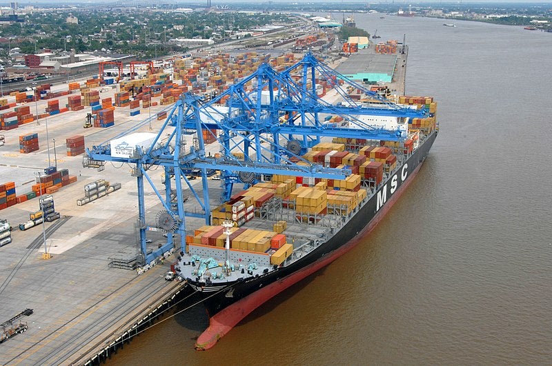
It’s time to build resilience on the river
The Corps has a robust program to clear navigation channels to ease traffic, dredging 78 million cubic yards of sediment and other material annually and using about 38% of dredged sediment for the purpose of restoring wetlands. By pumping this sediment into wetlands, they have constructed approximately 68 square miles of land through this program to date.
This is a great start, but the Corps should take a more holistic approach to river management that encompasses navigation, ecosystem restoration and flood protection to help confront new challenges.
One way the Corps could do this is with sediment diversions, which the State of Louisiana is currently advancing to address its coastal land loss crisis. A sediment diversion consists of a gate built into existing Mississippi River levees and a conveyance channel to deliver sediment from the river to build and sustain nearby wetlands, providing a vital buffer from storm surge and sea level rise. Decision-makers at the state and federal level must prioritize solutions that can help the navigation industry become more resilient on the Mississippi River. Share on X
Another example is Changing Course – a bold and innovative design competition that brought engineers, designers and planners together to envision a resilient future for the river in the face of climate change. Three winning teams created designs for how to use the Mississippi River to rebuild wetlands over time while also meeting the needs of navigation and flood protection. Louisiana’s 2017 Coastal Master Plan referenced Changing Course as an example of the type of collaborative, innovative planning needed to confront future challenges on the river.
In a recent sign of progress, Louisiana Gov. John Bel Edwards announced his administration would work with the Corps and others “to more holistically manage the Mississippi and Atchafalaya Rivers to integrate the goals of flood protection, ecosystem restoration, navigation, water quality and fisheries habitat.”
Going forward, the Corps has the opportunity to update a century-old approach to river management with one that accounts for climate change while balancing the needs of navigation, communities and the environment.


