


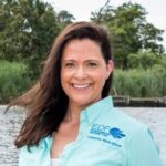
How can we reduce losses from coastal storms? Monitor the health of our coasts.
Posted: in Coasts and Watersheds
Written By
Share
With a rapidly changing climate and more frequent extreme events like floods and droughts, comprehensive environmental monitoring will be increasingly important for coastal planners, farmers and others invested in natural resource management.
Monitoring efforts can cover the whole spectrum of environmental and socioeconomic concerns to provide a holistic picture of ecosystem health over the short- and long-term. This can help to inform future decisions and planning based on the most recent conditions and trends.
However, it can be difficult to coordinate monitoring efforts across political boundaries and agencies, and monitoring is expensive to maintain over time.
Luckily, Louisiana is already a world leader in utilizing collaborative monitoring data to inform coastal restoration and planning efforts.
The gold standard for collecting and sharing monitoring data
Louisiana’s Coastwide Reference Monitoring System (CRMS) is the largest freely accessible coastal monitoring program in the world.
Created in 2003 to track the progress and overall effectiveness of state-led restoration projects and the status of Louisiana’s coastal landscape, CRMS includes monitoring data collected by multiple agencies and shared collaboratively in one place.
Data can be openly accessed online and downloaded and manipulated as needed, at no cost. CRMS also has chart capabilities that make it easy to visualize environmental trends over time in specific sites or regions.
In addition to providing critical information on coastal ecosystem health, data also offer insight into the positive benefits and return on investment delivered by restoration projects. Coastal communities can learn a lot from Louisiana, which has the largest freely accessible coastal monitoring program in the world. Share on X
CRMS brings federal and state agencies together to team up on coastal monitoring efforts – making monitoring more cost- and time-efficient for agencies, and more accessible for coastal researchers and residents.
With even more data, we can reduce risk and build resilience
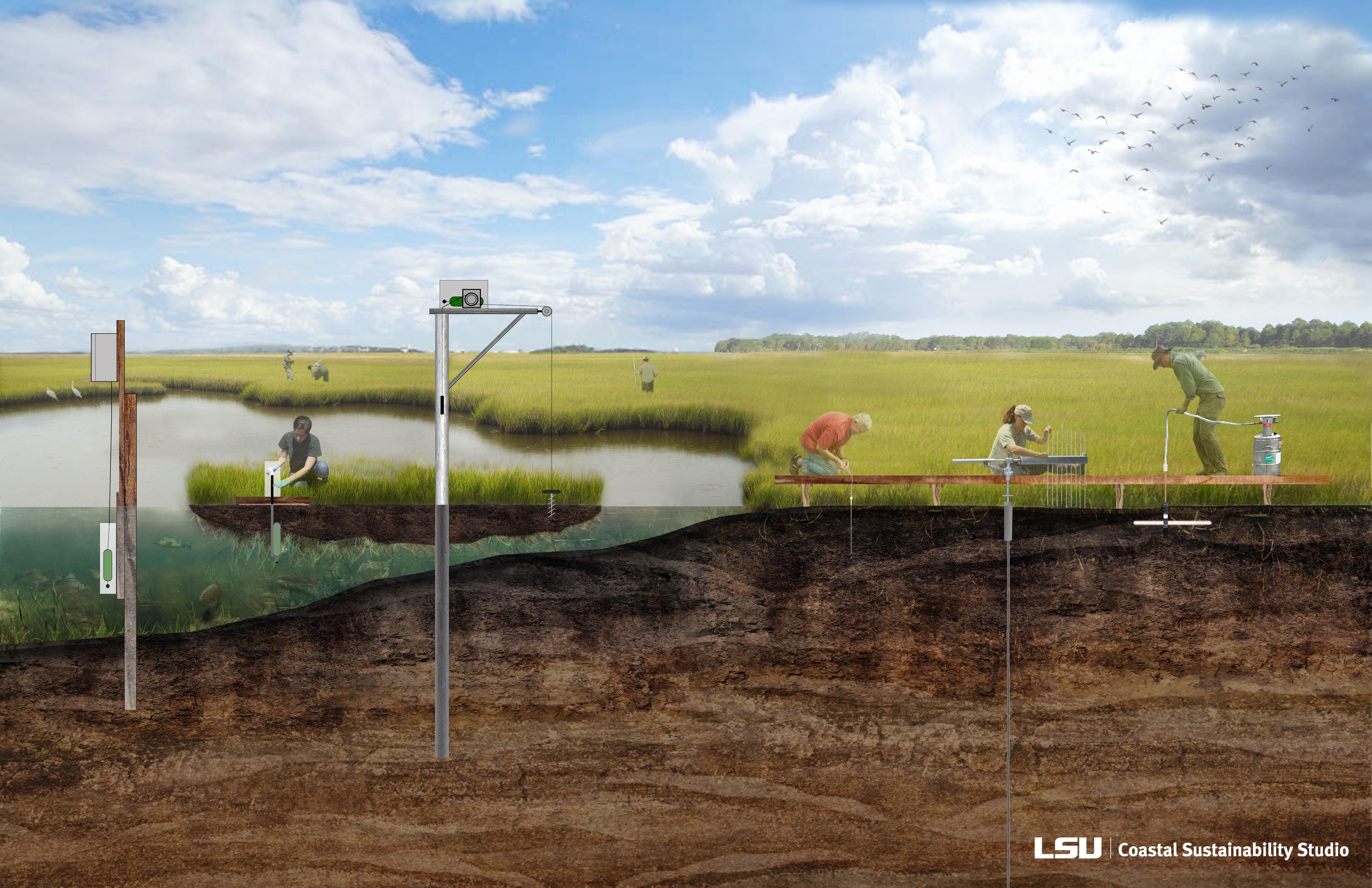
Louisiana is currently developing a System-Wide Assessment and Monitoring Program (SWAMP), which will provide a comprehensive framework to gather all active state and federal agency monitoring efforts along the Louisiana coast. Pulling from more than 1,700 monitoring sites, including CRMS, data collected by SWAMP will span environmental, ecological and socioeconomic conditions.
With nearly $80 million dedicated to SWAMP development and implementation over the next three years, the state plans to leverage long-term data to increase its knowledge capacity as it moves forward with its ambitious Coastal Master Plan, which relies on monitoring for its long-term environmental modeling predictions of future conditions with and without coastal restoration projects.
Data analysis will also focus on risk reduction and capacity building – key considerations for coastal restoration and protection projects in a state faced with sea level rise, subsidence and other climate change impacts with high levels of uncertainty.
Louisiana as a leader for other coastal communities
Louisiana’s strategy of bringing state and federal agencies together to collaborate could be applied to other Gulf Coast states and coastal regions across the world.
On-the-ground educational outreach and other community engagement strategies, such as webinars on how to access and use online monitoring databases, should be use to engage the public and promote better communication between countries, states and citizens, especially those who are most vulnerable.
Collaborating is certainly more effective than operating in silos, and it’s time for other states and countries to utilize comprehensive monitoring programs that help researchers and community members plan for the future.

One Comment
Data only has value if it is used. CPRA reported at the 2018 State of the Coast Conference that 70% of the CRMS stations in the delta region were measuring “positive elevation trajectories” relative to a fixed station. That is to say that they are gaining elevation. Most stations are measuring rates of sediment accretion greater than estimates of either subsidence or sea level rise. The 2017 USGS Land Area Change Map (SIM 3381) showed that coastwise observed measurements of total wetlands area increased by about 200 square miles between 2008 and 2016.
These are very significant findings that deserve thorough investigation, but the data appears to be systematically suppressed because they do not fit the “crisis narrative” for the Louisiana coast. There is no data that shows that coastal Louisiana is currently losing wetlands area.